
with thanks to Lonely Planet
After a long flight and a very long lasting security check of more than 1 1/2 hour we finally could drive to our Parc 55 Hilton Hotel in San Francisco. Close by is Union Square and from here all tour busses leave for different directions around the city. First we took the Downtown Big bus that brought us to Fisherman's Wharf. The first day we were there it was cold and rainy, but two days later the sun was shining, it was much warmer and it was full of people.
 |
 |
 |
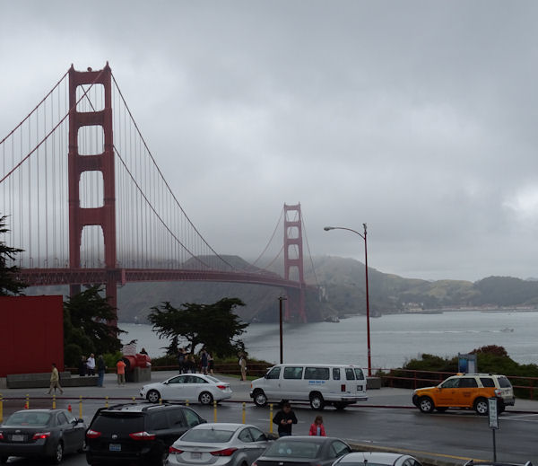
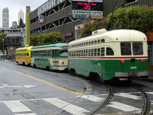
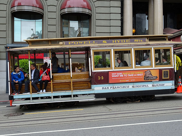
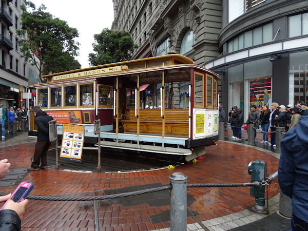
Apart from the Golden Gate Bridge that we saw from the top of an open double decker bus, where it was freezing cold and windy, San Francisco is also famous for its public transport; the old street cars and the even older cable cars. With a wheelchair the street cars and also the busses are very well accessible, but the cable cars are not, unfortunately, but therefore we didn't have to stand in line for 1 1/2 to 2 hours to get in either :-)
 |
 |
 |
 |
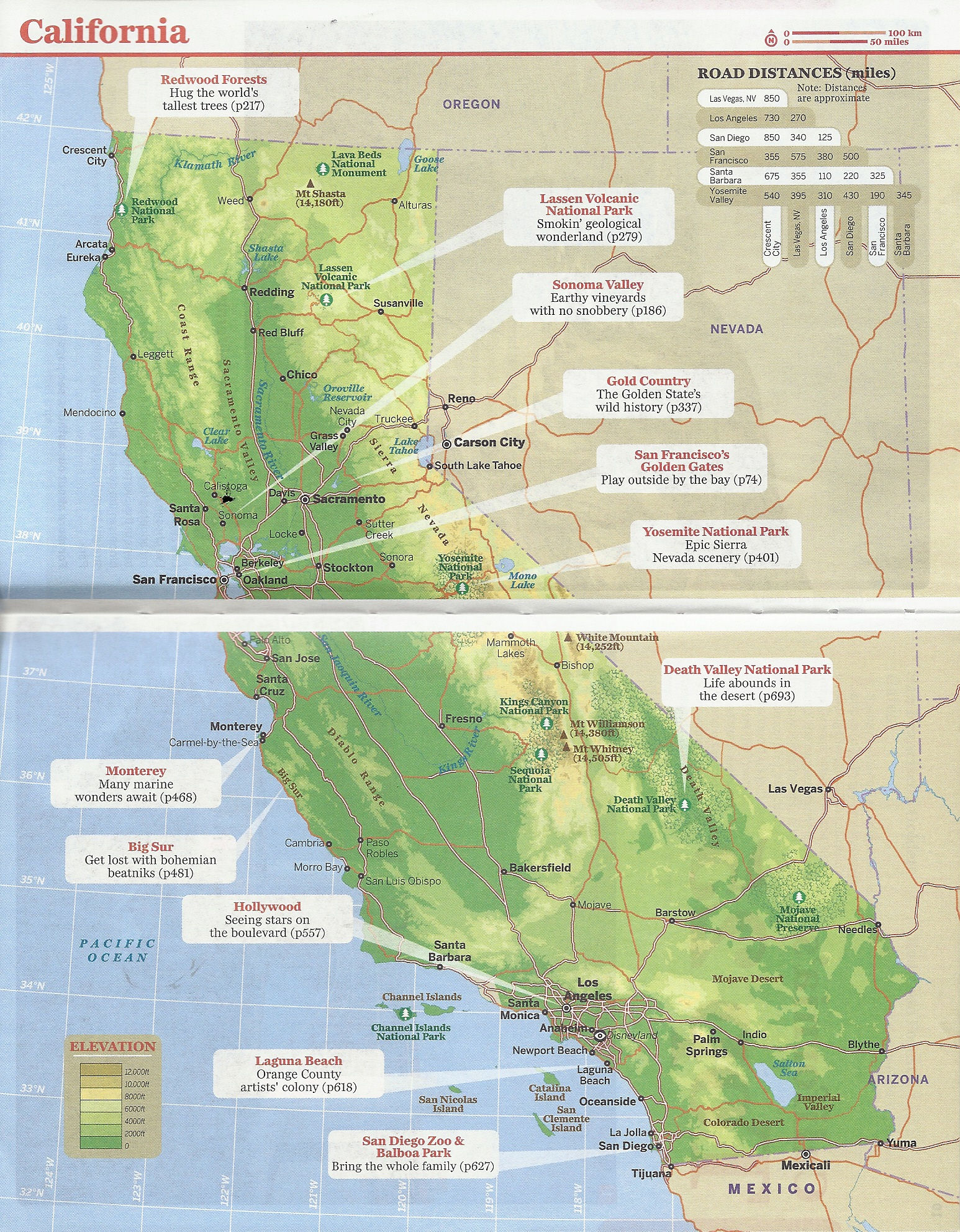
Yosemite and Death Valley are amongst the most famous National Parks in the USA. They are very different from each other. In mid May some parts of Yosemite are still closed because of snow. Death Valley at the contrary is very hot and dry, though floods occur from time to time. But luckily not when we were there.
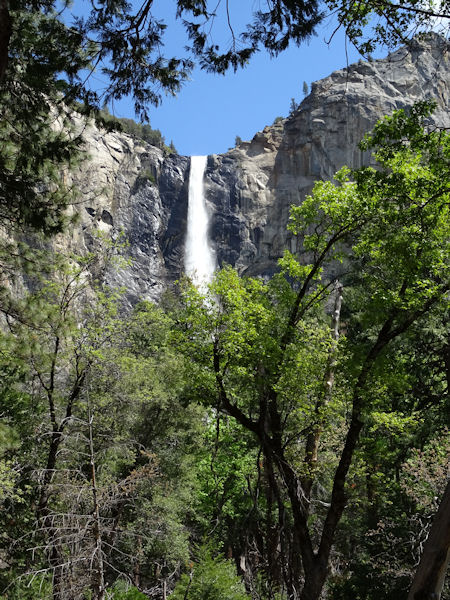
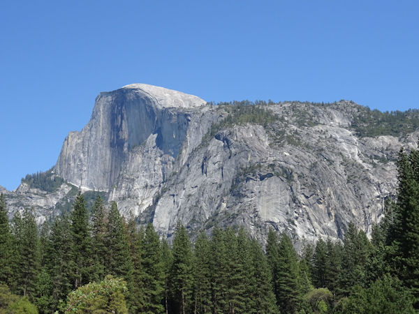
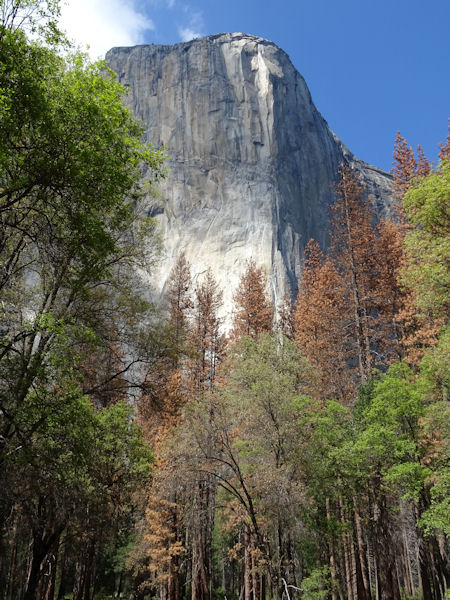
Yosemite is very green with many trees, beautiful waterfalls, like the Bridal Veil Fall. The Half Dome is a huge rock or mountain looking like a dome of a cathedral. El Capitan is another mountain, often used by climbers to whom the steep slopes are an enormous challenge. On the way to Glacier Point in another part of the park there still was snow aside the road and some tops of the surrounding mountains had snow caps too.
 |
 |
 |
 |
 |
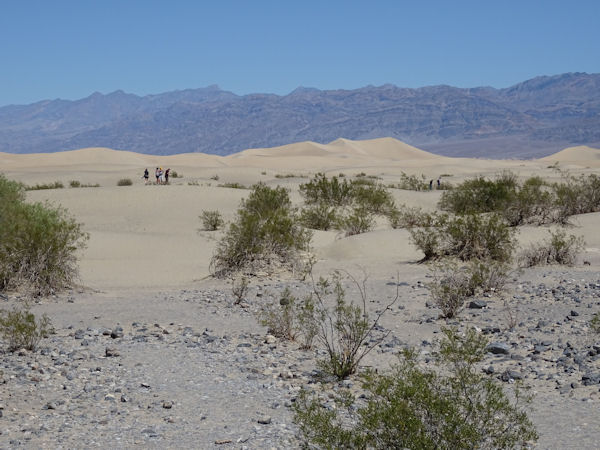
Since the Tioga pass was closed when we were in Yosemite we had to drive a long way south and east via Bakersfield to Ridgecrest, where we spent a night. From there it was a short four hour drive to Death Valley. Entering the Valley from the west Stovepipe Wells is the first village you will visit. It has a general store, a fuel station and a motel, and it is one of the few places where you can have a comfortable stay in the Valley. Stovepipe Wells is known for its sand dunes.
 |
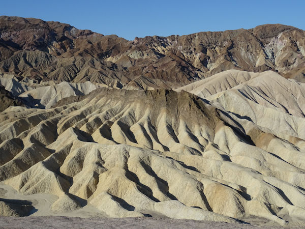
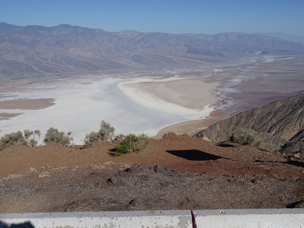
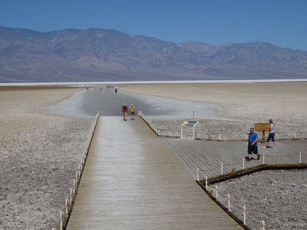
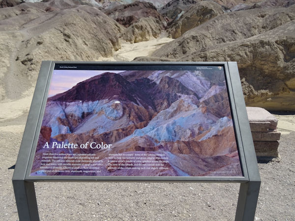
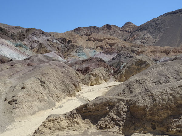
We stayed in the bigger Ranch at Furnace Creek, middle in the heart of the valley. A huge place with camp sites, a motel, three or four restaurants, a store, a museum and a great pool. And very close to the highlights like the beautiful Zabriskie View Point with very special rock formations, Dantes View Point with a spectacular view on the Badwater down below and the salty Badwater itself. On the way back we drove over the Artist Drive and saw the very nice Artist Palette. The colors in the rocks are caused by the many minerals here.
 |
 |
 |
 |
 |
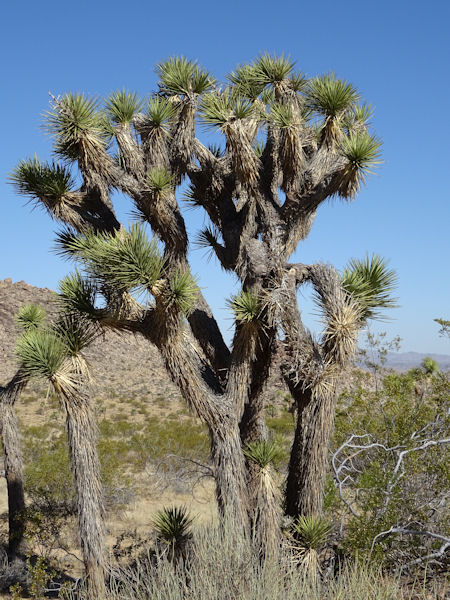
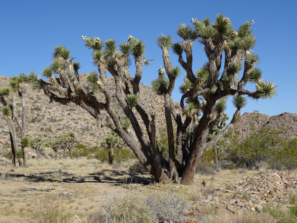
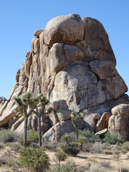
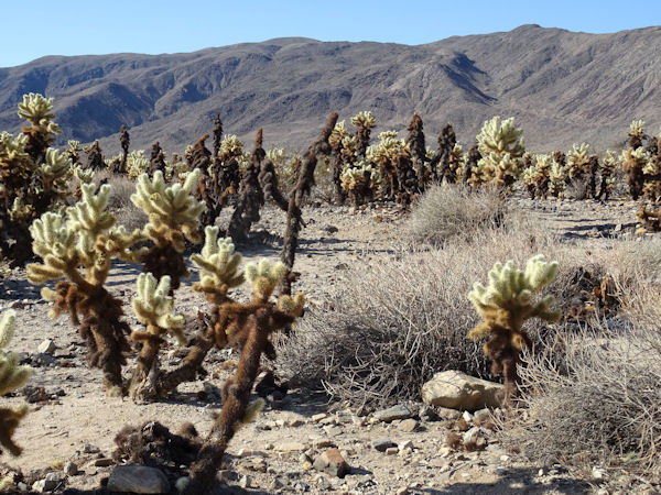
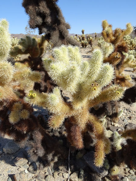
It was a long drive from Death Valley via nice Mojave National Preserve to Joshua Tree National Park. In Mojave National Preserve we already saw our first Joshua trees and they are amazing. We stayed in 29 Palms, a rather large widespread city at the north side of Joshua Tree NP. In Joshua Tree NP we saw many more Joshua trees as well as strange rock formations, funny small camp sites and also a peculiar Cholla cactus garden on our way to Phoenix and Tucson. Don't touch them; their needles are very sharp and very difficult to remove from your skin.
 |
 |
 |
 |
 |
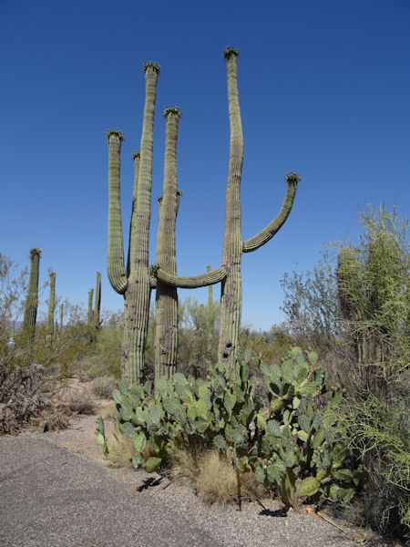
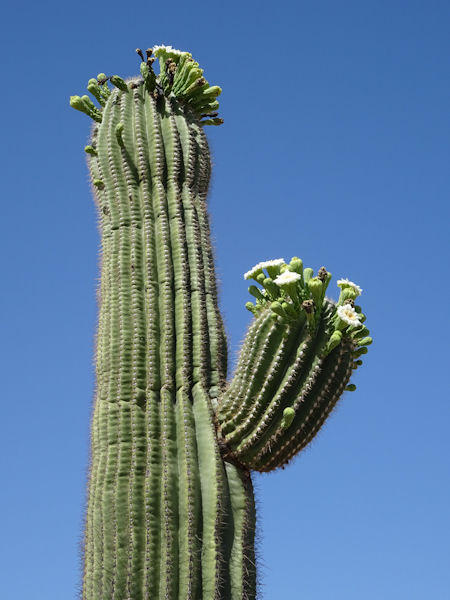
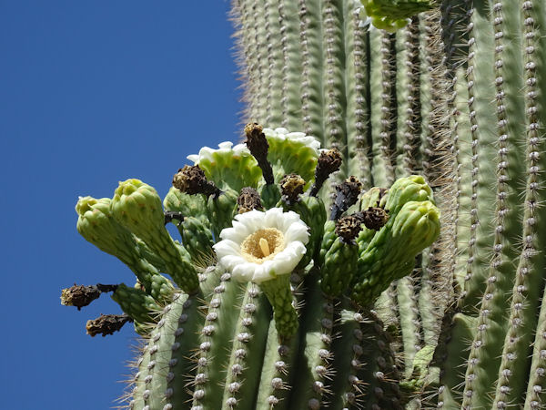
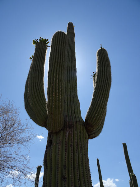
Before we arrived in Tucson we first visited West Saguaro NP, to us a nicer park than the eastern park. The western park has a lot more beautiful and huge Saguaros, a nice one way dirt road and a very fine walkway, even suited for wheelchairs. It takes a long time before the Saguaros can grow to e.g. a four arms cactus, up to a century. Both parks deserve your attention, unless you don't have time to visit them both. It is nice to see them in the morning and to stay at your hotel pool in the afternoon.
 |
 |
 |
 |
 |
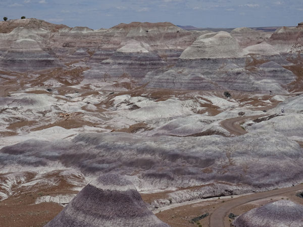
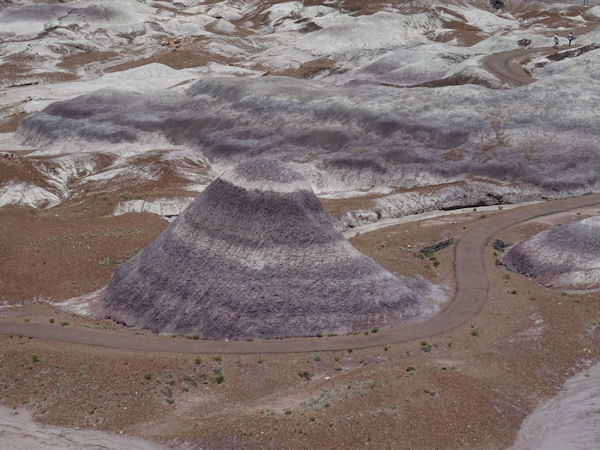
Petrified Forest and Painted Desert
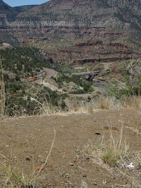
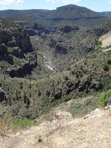
It took us quite some time to leave Tucson; so many traffic lights. But when we finally got out of the city the interesting drive through Apache Indian Reservation land begun. At first it was rather flat, but when we got to the Salt River Canyon the road became steeper and steeper and more and more winding. And great views over this canyon, the bridge crossing the river and the narrow road. Luckily there are passing lanes and also stopping places so you don't have to worry about the traffic behind you.
 |
 |
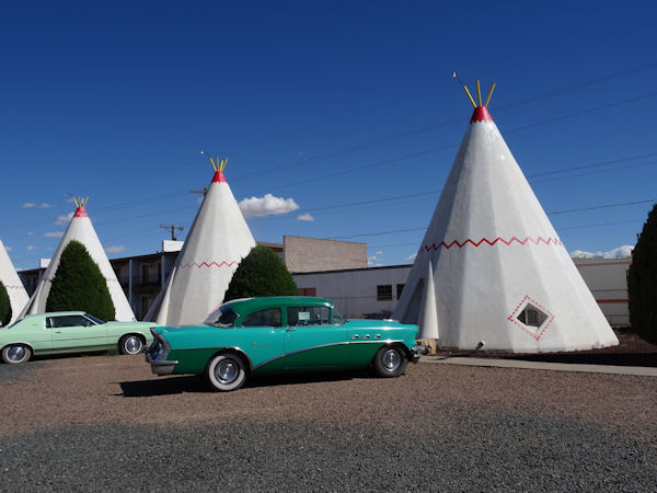
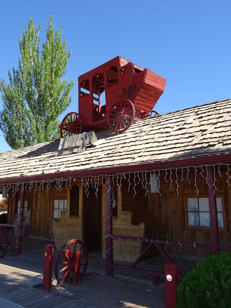
Holbrook, a good place to visit the Petrified Forest and the Painted Desert, and one of the famous cities on the Mother road of all Roads, Route 66, is a strange place to be. The most famous things are the Wigwam motel and Route 66. We stayed in a hotel next to the Wigwam motel and next to the Stagecoach Restaurant. Very authentic places :-) And on Route 66!
 |
 |
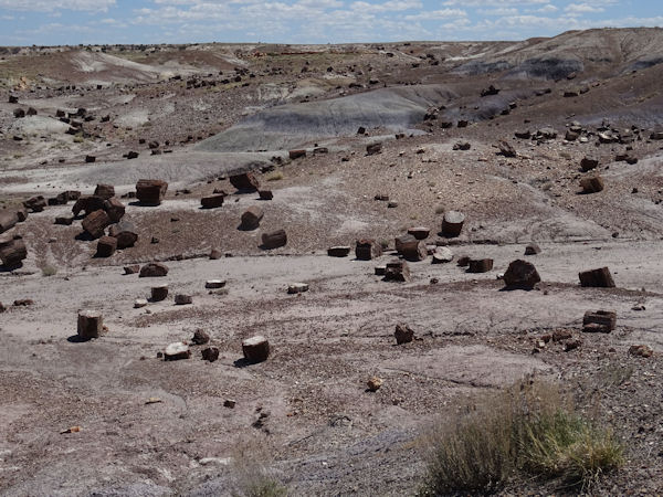
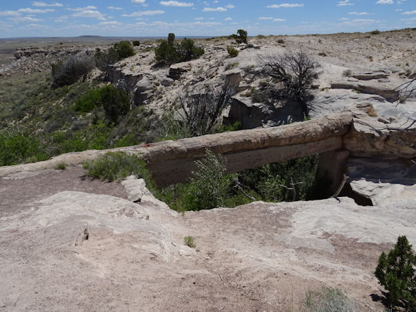
Quite near to Holbrook is the south entrance of Petrified Forest NP. Some 180-200 millions of years ago there was a huge forest here and it rained a lot, so trees were swept away and rivers brought them far from their original places. Together with volcanic activities and ashes these trees were fossilized. Minerals in the ground and in the water added their colors and nowadays we have a beautiful area with petrified trees, nice rock formations, a natural bridge and a wonderful Blue Mesa. Unfortunately it stormed so hard that it was too dangerous for us to go down and make the walk. What a pity.
 |
 |
 |
 |
 |
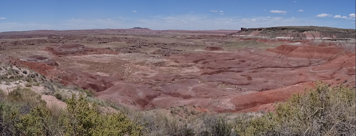
The Painted Desert NP is nowadays part of the Petrified Forest. In this part of the Painted Desert is the monument for Route 66, an old car, a sign and some memorial stones. But Painted Desert is bigger than only the part of Petrified Forest and we drove through that area a couple of days later on our way to Page.
 |
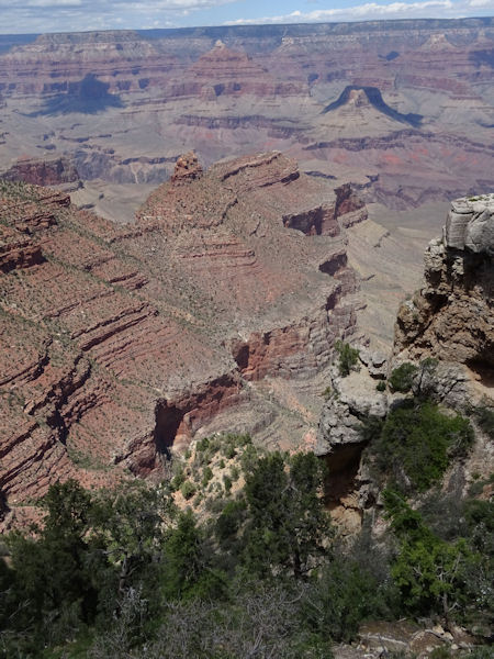
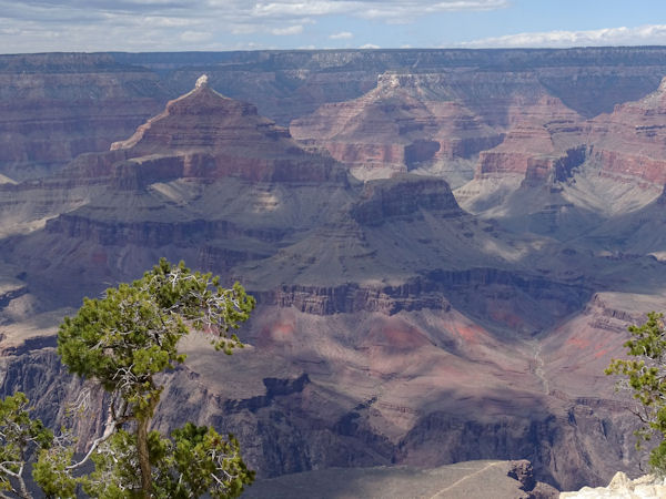
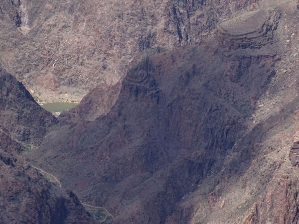
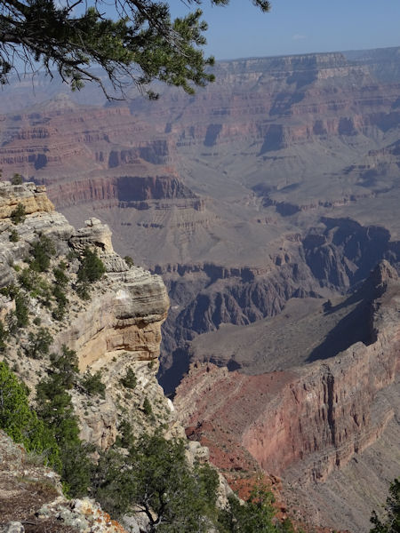
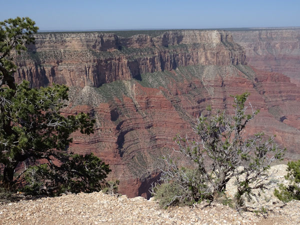
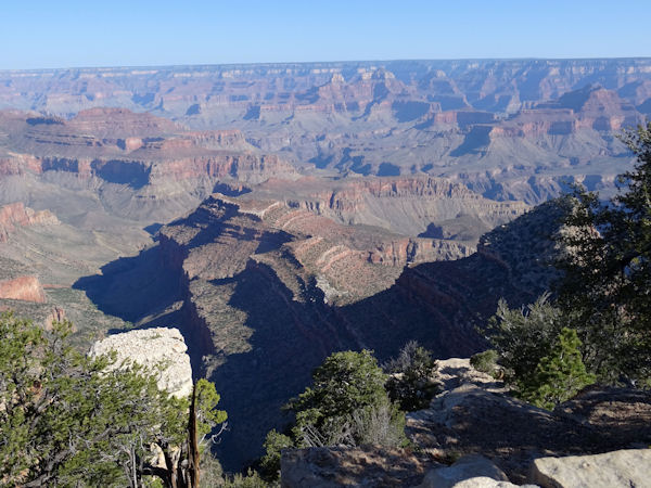
But first we drove to the Grand Canyon. The Grand Canyon is remarkable; so huge, so big, so deep, so great. We stayed in Tusayan about 2 miles from the south entrance of the park. Here is the Visitor Center where you can see the very interesting IMAX movie. Sometimes you have the feeling to move together with the helicopter or to keep hold to the boat if it moves over the waves of the Colorado river. We took so many pictures of the canyon that below is only a small exhibit of them. If you have a good look you can see the boats in the river waiting for their guests.
 |
 |
 |
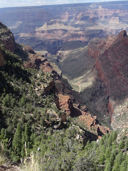 |
It is very busy in the park and parking lots fill up very quickly. Therefore the view points close to the Rim can only be reached by shuttle bus, so it is advised to visit the Park by shuttle bus. At 08.00 hours the first shuttle bus leaves Tusayan Visitor Center for Grand Canyon Village. This purple line connects to the blue Village line which connects to the Red line along the Rim. There are many stops and even with a wheelchair it is easy to hop on and off the bus to see all the great view points. From these points there are spectacular views over the canyon, the Colorado river far down in the canyon and the beautiful scenery around.
 |
 |
 |
 |
Glen Canyon and Grand Staircase Escalante National Monument
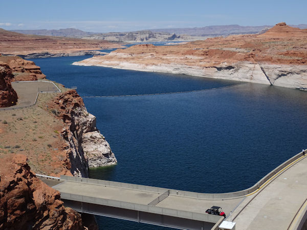
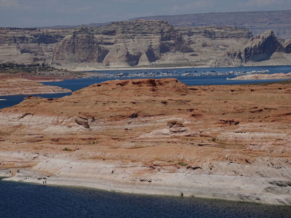
We drove eastbound through the Grand Canyon park and then north to Page. Here is the second largest dam in the USA, the Glen Canyon Dam. It is only a few feet smaller than the Hoover Dam near Las Vegas. The lake that was created when building the dam, Lake Powell, is very large and has many recreational sites for camping and boating. If the sun is shining the water of the lake is very dark blue.
 |
 |
 |
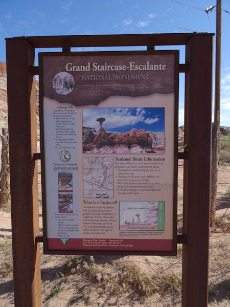
From Page to Kanab is a short drive. Therefore we decided to make a detour in the Grand Staircase Escalante National Monument. A short stroll first and a longer and more challenging drive later over a dirt road to the former Old Paria Movie Set, which, so it turned out later, was burned down in 2007. This road was very small, winding and steep and since we couldn't find the movie set after an hour we decided to go back to the highway.
 |
 |
 |
 |
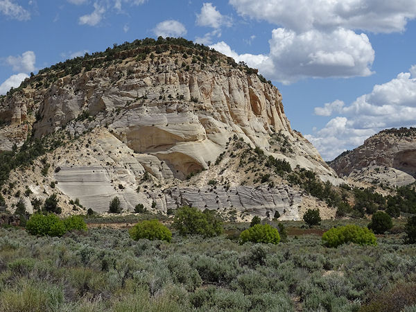
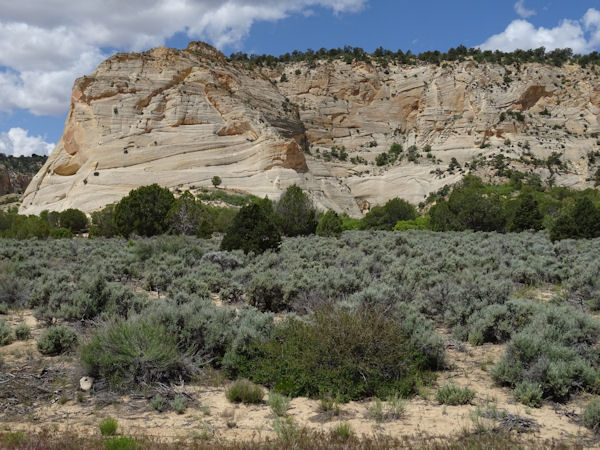
Some miles further west we took the Johnson Canyon Road northwest to the White Cliffs and to Glendale. The road changed from a nice and paved road into a dirt road. In Glendale it changed again to a paved one and from there it went south to Kanab where we stayed two nights. The Holiday Inn Express didn't have a handicapped room but they contacted the very nice Comfort Suites where we got a great room. And Holiday Inn Express paid the price difference. Great service!
 |
 |
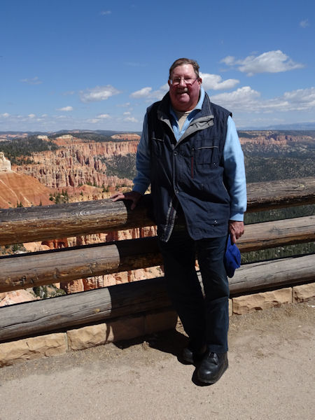
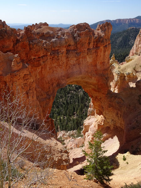
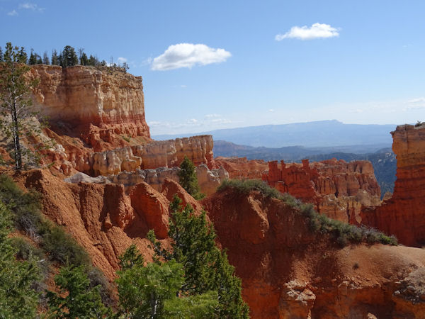
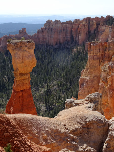
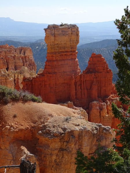
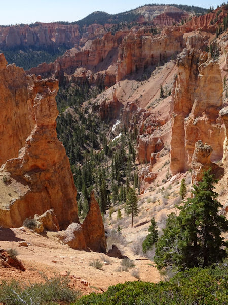
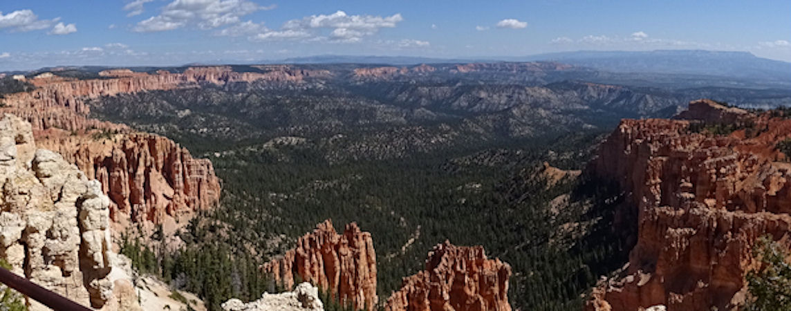
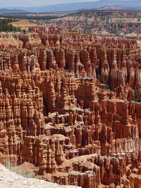
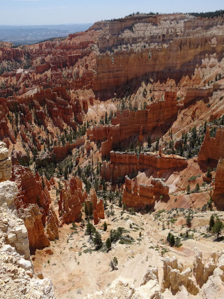
From Kanab to Bryce Canyon National Park it is about 100 km. Before you enter Bryce City you pass the beautiful Red Canyon Park. Bryce NP is remarkable with its red and white rocks, all vertically orientated. Since we were already there before nine o'clock it was still very quiet and we could see all the view points easily and without many people. The sights are unbelievable; rocks balancing on each other, a natural bridge and far away the Grand Staircase Escalante again. Almost all view points can be reached by a wheelchair. Only the very, very nice Inspiration View Point is too steep to roll on or off. Unfortunately from there the view over the Bryce Amphitheater is one of the most beautiful sights.
 |
 |
 |
 |
 |
 |
 |
 |
It really is a very nice and beautiful park. Take care, some of the view point are above 9,000 feet, approx. 3,000 metres. So it might be cold.
 |
 |
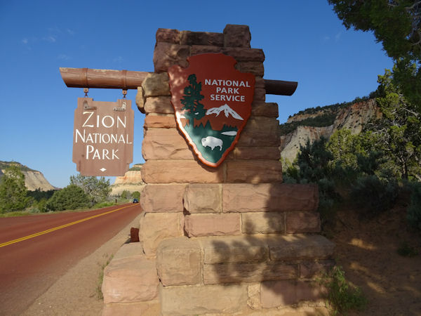
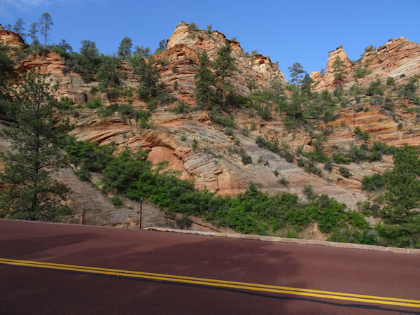
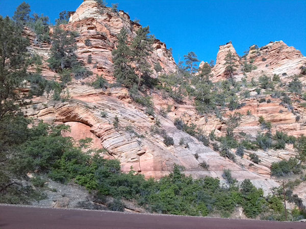
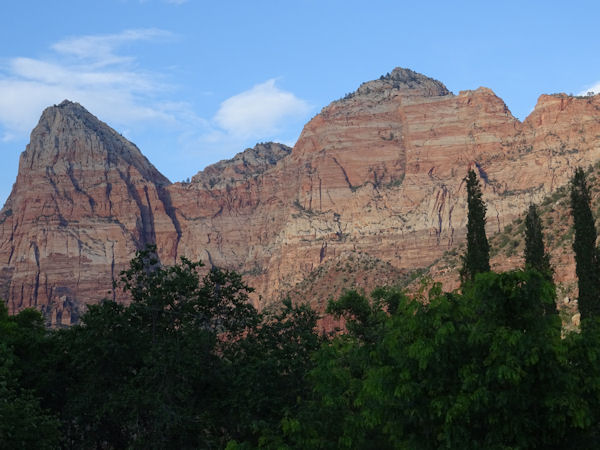
Contrary to Bryce NP everything in Zion NP is horizontally orientated. When you enter Zion from Kanab one of the first things you will see is the Checkerboard Mesa. A rock with both horizontal and vertical stripes and it looks like a checkerboard. Hence the name. The roads here are red colored and so are many of the rocks. Others are white with horizontal stripes. The road has two tunnels, a short one and a very long one. If large vehicles pass, it is a one way lane, but without large campers or busses you suddenly see upcoming traffic. That is a bit confusing after you have waited for several minutes. Then you expect a free way to go. After the tunnel it is a steep way down into the valley. From here at the Visitor Center you have to take a shuttle bus into the canyon. Other traffic is forbidden unless you stay at the Zion Lodge. A special permit is then required.
 |
 |
 |
 |
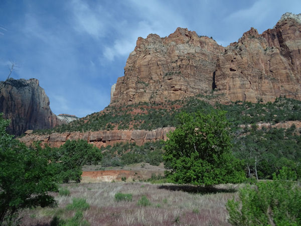
The view points in this canyon are difficult to reach for a wheelchair; lots of sandy paths, bumpy and not flat. The canyon is very small and if the sun is not shining in it, it is dark and gloomy. When we were there the weather started beautiful but in the afternoon we got a huge shower and there might have been a flashflood in the canyon which was not expected. During the rain we couldn't see the mountains, but luckily a few hours later the sun came back and the mountains were clear and beautiful again.
 |
 |
 |
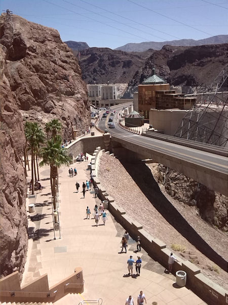
Before we drove to our hotel in Las Vegas we first visited Lake Mead and the close by Hoover Dam. The biggest dam in the USA as mentioned before. At the dam it is very crowded. You can park your car at several parking places at USD 10 per site. If you have a handicapped card, however, it is free. So we parked at three or four parking lots and had nice views on the dam.
 |
 |
 |
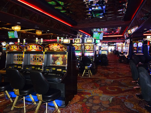
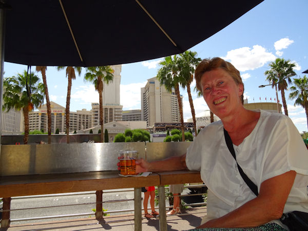
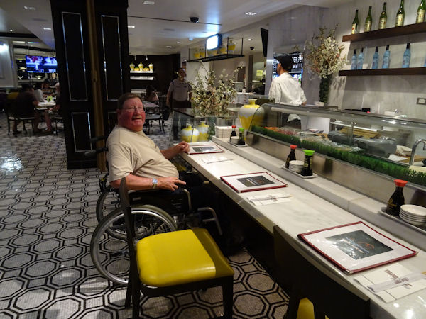
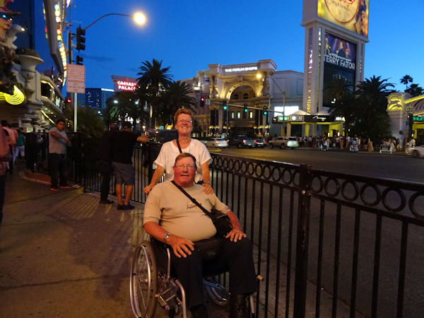
The Strip in Las Vegas consists only of casinos and hotels (with casinos). Before we could reach the front desk of our hotel we had to roll through the big casino of Hotel Casino Royale. Fortunately there is another way to bring your luggage from the car to your room, but then you need a room key card. One afternoon and evening is enough to see all interesting places in this city, including having a drink watching the sometimes strange people and having a meal. Of course food courts are in the middle of a casino. When it becomes dark in Las Vegas the lights of all casinos and hotels get on and you can take pictures without flash.
 |
 |
 |
 |
 |
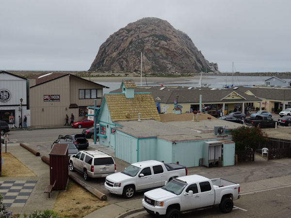
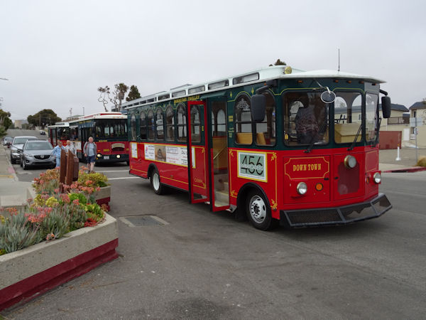
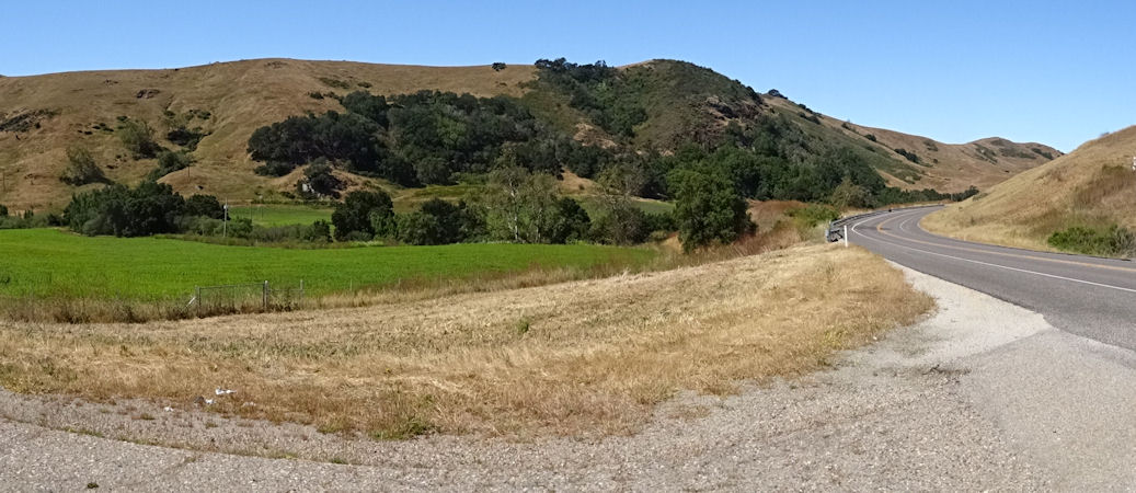
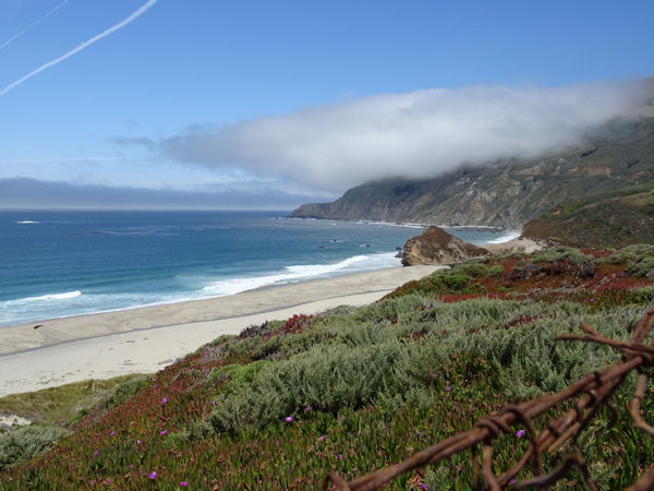
Coming from the warm and dry desert in Nevada and Arizona it is a bit of a shock to arrive at the chilly and often foggy west coast of California. Morro Bay is a nice little town with a big rock in the Pacific Ocean and a lovely bbq oyster bar. The Trolleys only go on weekends and on Memorial Day Monday. We just heard that on time and Victoria, Marty and Camille drove us through downtown, along the waterfront and to the north of the town. It was very kind of them that they did that for "their friends from The Netherlands". We were their only guests at that time. Earlier that day it was very crowded so they told us.
 |
 |
 |
Just a few miles from the coast the weather in the mountains is bright and sunny again, so the next day we decided to drive through the mountains to Cambria. A very wise decision since along the coast it was mainly foggy again. But we had some sunshine in Cambria as well.
 |
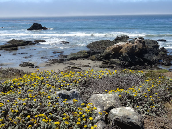 |
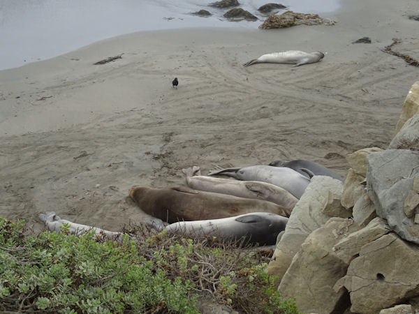
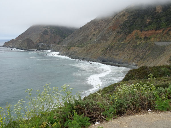
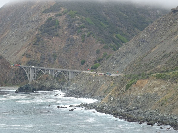
Over Highway 1 along the coast we drove towards Monterey. We saw some elephant seals near Hearst Castle, that was disappeared in the fog. It was sometimes so foggy that we could hardly see where the road was and that was a bit frightening. Fortunately we got some better weather later that morning.
 |
 |
 |
 |
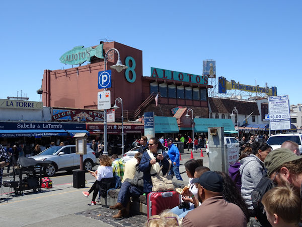
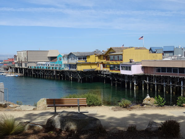
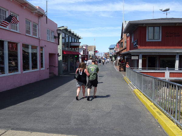
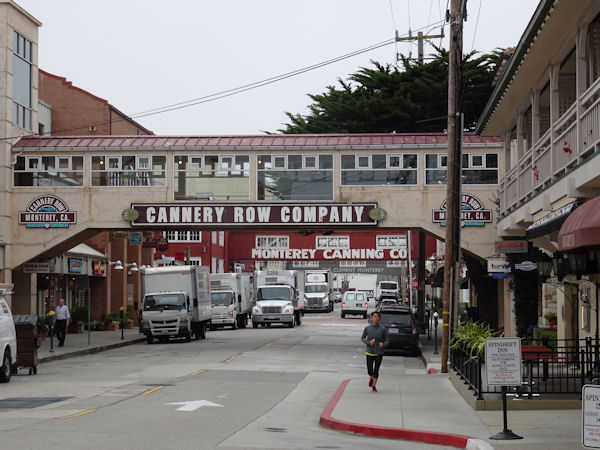
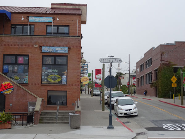
It was remarkable, but in Monterey we mainly had sunshine. Fisherman's Wharf in the sun is a great place. The next day only early in the morning when we saw Cannery Row it was clouded. In the 19th and 20th century the sardines were canned in the many factories here. The writer John Steinbeck made this street famous with one of his books. Nowadays it is a fancy street with hotels and restaurants.
 |
 |
 |
 |
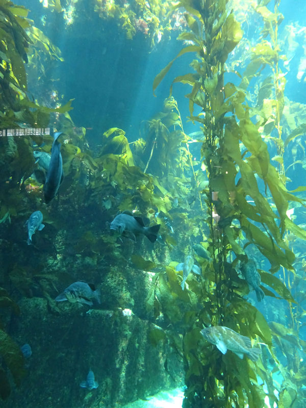
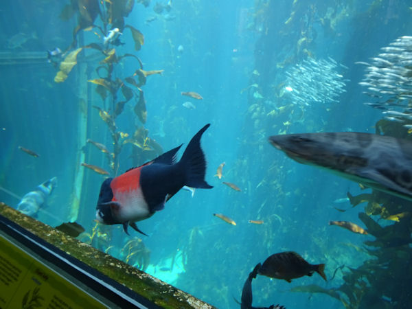
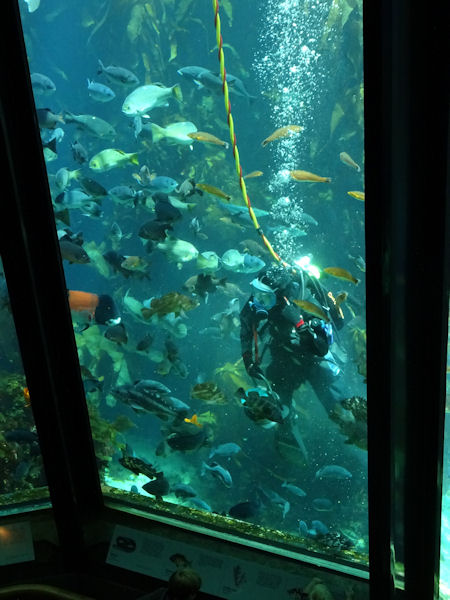
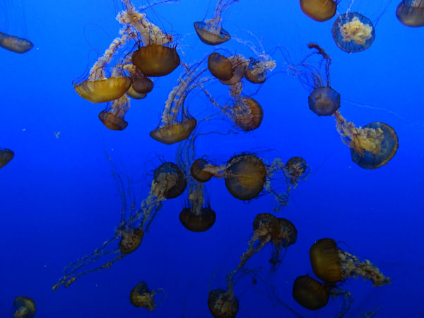
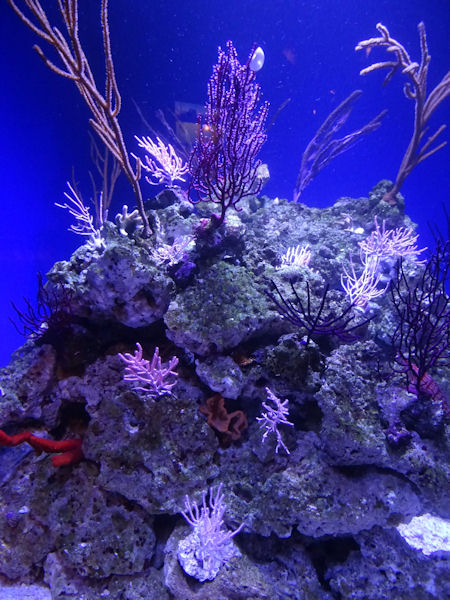
We were told that the Aquarium would open at 09.00 hrs, but that is only in weekends. On other days it opens at 09.30 hrs, so we had to wait some time. The Aquarium is beautiful. It has a large kelp forest, there are many feedings, e.g. the sea otter feeding and the deep sea feeding and also a hand fish feeding with a diver in the kelp forest. Amazing! But there are also jelly fishes and corals and many other interesting things to see.
 |
 |
 |
 |
 |
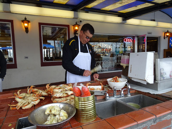
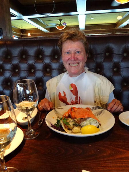
After our 4-5 hour visit to the Aquarium we went back to the Wharf and had a very tasty seafood meal at the Old Fishermen's Grotto.
 |
 |
Our holiday was almost over. Only one more day to drive back to San Francisco where we spent the last night in an airport hotel with view from our room at the airport. We had a wonderful holiday again and hope to come back to the USA once more in the coming years.
 |
|